European Project tests new SAR tools
Through sharing of data between vessels, new tools developed to enable more digital communication can make Search and Rescue operations both faster and better.
When navigating a ship through the less trafficked routes of the world, for example in Arctic waters, the ability to share data could take on increased significance in coming years. By using a new service developed with funding from the Nordic Council of Ministers and supported by the European project EfficienSea2, seafarers will be able to automatically exchange and coordinate vessel locations and search patterns while conducting SAR operations.
The service, which is available for all ships sailing through Arctic waters, is free of charge and only requires a functional internet connection and a log-in to the map-based platform ArcticWeb, has just been successfully tested at simulations in Gothenburg by Chalmers University of Technology and the Swedish Maritime Administration.
EfficienSea2 Work Package Leader Cajsa Jersler Fransson from the Swedish Maritime Administration explains:
“We have done three days of full-bridge simulations with mariners to ensure the readiness of the service and to test how the digital data can best help the human beings who will be sailing the ships and leading the SAR operations. We feel confident that it will benefit everyone involved in conducting SAR operations,” she says and continues:
“The most significant feature of the new Search and Rescue tools is how a coordinator can assign specific areas to different vessels and benefit from pooling many ships through a digital platform. Rather than doing everything over radio, all ships will be able to see updated search patterns directly on ArcticWeb. It will give much more situational awareness when conducting emergency operations.”
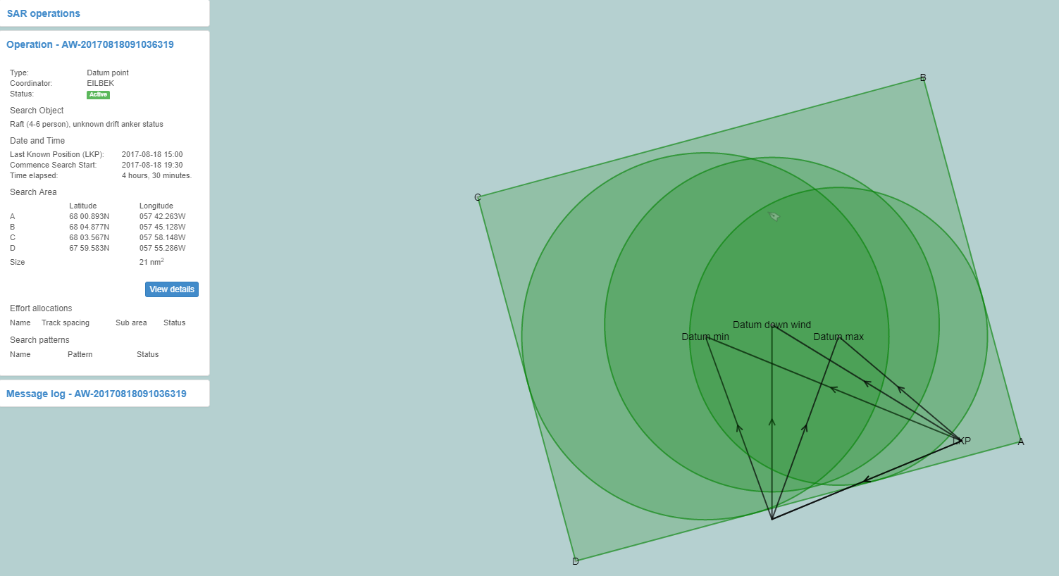
A screenshot taken during the simulation
Open Source Development
The digital SAR tools have been developed in open source, which makes the service open for all to adapt to their own specific platform and area. Cajsa Jersler Fransson is hopeful that other projects, companies or organisations will do that:
“The mariners saw some obvious benefits with the new service, with the main one, naturally, being the reduction in time and energy spent on calculating different search areas for different ships. I think the need for the service is strong and now we’ve done the groundwork in EfficienSea2 for others to benefit from,” she says and adds that a large report will be produced on the new tools, taking human factors into account.
Those interested in the new tools can find more information on EfficienSea2’s website. Developers can find the source code on GitHub under “ArcticWeb”.