Regional route sharing made possible in the Baltic Sea
Maritime digitalization carried out in the European project EfficienSea2 has enabled effective route sharing between different VTS systems in the Baltic Sea. It has the potential to drastically cut the reporting effort for the ship’s crew, while offering authorities a better ability to ensure safe traffic at sea.
The days may soon be over when mariners have to pick up a radio to take on the cumbersome task of reporting their vessel and route parameters every time they cross into a new VTS area – at least for those sailing in the Baltic Sea.
By cooperating with the Finnish Transport Agency as a part of the EU-funded project EfficienSea2, the Norwegian surveillance system manufacturer Vissim has become the first operator to integrate voyage data from the so-called ENSI-system (Enhanced Navigation Support Information) in their own vessel traffic monitoring system.
This ability, explains Max Semenov, Chief Technical Officer at Vissim, will allow VTS centres and navigators to drastically reduce their reporting burdens:
“Today, a ship sailing from Helsinki to Oslo passes many VTS zones and has to share voyage data with all of them. Some require more than others, but in most cases some form of radio contact is necessary. Being able to integrate voyage information from a different route reporting scheme and distribute the information to all relevant actors along the route will make it possible to report only once per voyage,” he says.
More feedback, better routes
The ENSI system has been developed in Finland and allows ships in the Baltic Sea to share their electronic route plan and the mandatory reports needed for the voyage with any VTS or SRS system using it. The ship will shortly thereafter receive feedback on safety issues, weather conditions and so forth from automated sources.
The ability to integrate ENSI with a VTS system is achieved by using the so-called RTZ format for route exchange, which makes it possible to share the electronic route with VTS centres or other stakeholders along the route. For Vissim, and potentially other equipment manufacturers, this will allow them to offer new possibilities for maritime actors using their technology, while ENSI may prove even more beneficial for its users:
“Often, VTS and SRS centres will have route recommendations or restrictions based on draught or safety hazards. With this integration they will have a much simpler time giving feedback. They will receive the reports and route plans in a clear, digital, way with little room for misunderstandings – and they will have much more time, as they don’t have wait for the ships to enter their VTS domain before receiving information,” explains Mikko Klang, a consultant for the Finnish Transport Agency on ENSI-related issues.
Max Semenov of Vissim also sees the added safety as a selling point to their customers:
“By being first movers on this, we hope to offer our customers enhanced situational awareness while at the same time being able to decrease the mental workload placed on VTS officers,” he says.
Global potential
At first, the ability to integrate is directly beneficial for the part of the Baltic Sea Region covered by both ENSI and Vissim, but more important is the ambition of the EfficienSea2 project to have a global impact. By demonstrating how such route-sharing capabilities can be developed between different systems, EfficienSea2 hopes to lay the groundwork for future efforts toward smarter navigation.
“The principles used to integrate ENSI’s and Vissim’s systems can be applied to many other regions of the world. When a captain knows his or her route and which waypoints they will pass, it makes little sense to have to report that more than once. Hopefully, we are helping to eliminate that burden,” says Mikko Klang.
In order to exploit the new possibilities of integrating the ENSI data in other vessel traffic monitoring systems, manufacturers can find more information through the so-called Maritime Connectivity Platform or at the website of ENSI. Vissim will soon be offering their users to benefit directly from the work being done in EfficienSea2.
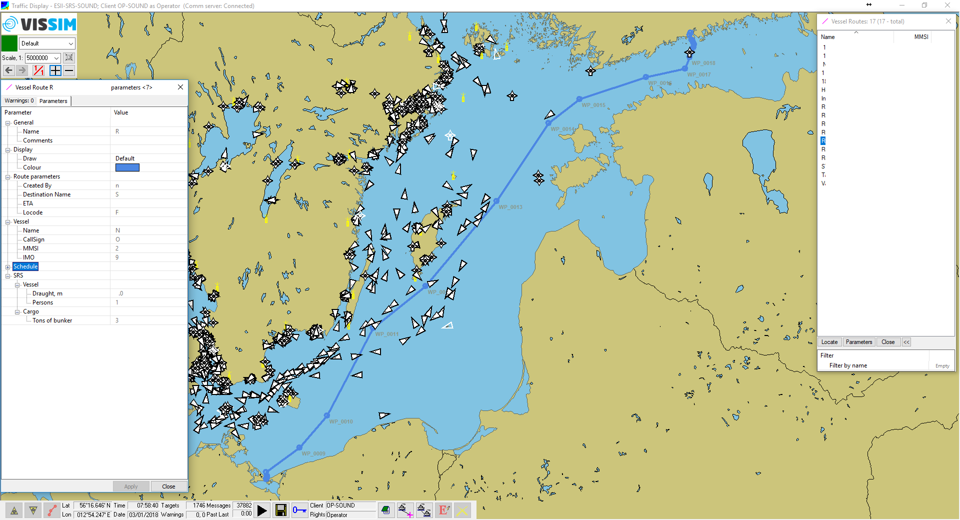
Today, VTS centres receive route information via radio contact and will then have to either plot it into their own system or not. With the new integration scheme, they can receive a full visualization instantly.